
This page is a detailed description of the line to read before or during your journey. It covers a mix of railway history, local history and information about the scenery you will pass.
Route: Glasgow – Crianlarich – Oban or Glasgow – Crianlarich – Spean Bridge – Fort William – Mallaig.
Trip Length: 3 hours to Oban, 3 hours 50 minutes to Fort William, 5 hours to Mallaig.
Trains depart from the attractive Queen Street Station on George Square. This large terminus was constructed in 1877 and has a wonderful glazed roof which spans the entire station including all the platforms.
While regular commuters may have got used to its splendour, the visitor can still take time to enjoy the station’s atmosphere, little changed from the days of steam, except perhaps for the glass being cleaner these days!
The station is located at the bottom of a steep bank which is climbed by all departing trains. In the days of steam, many trains had to have a helper locomotive on the rear to get out. Today’s trains make light work of the same incline.
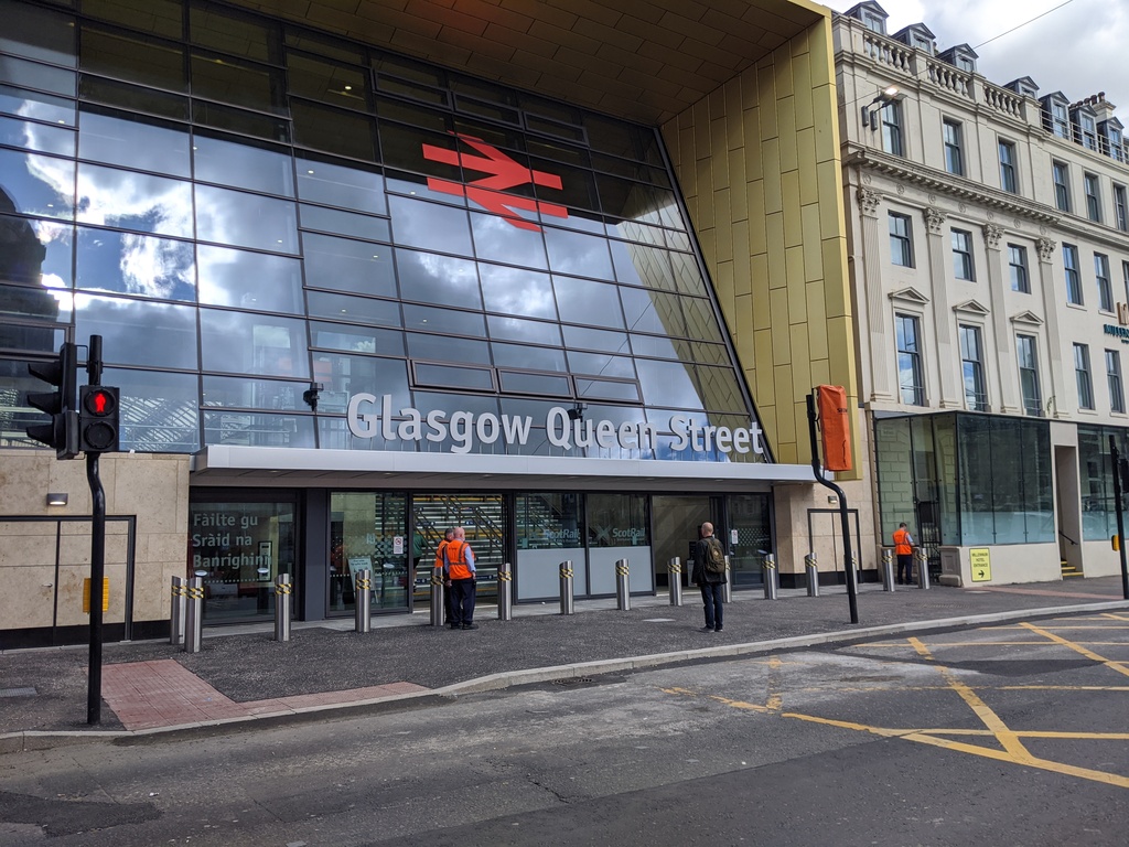
Welcome to Queen Street
Photo credit: “Welcome to Queen Street” by Daniel, CC BY 2.0
Departure from Queen Street Station takes the train through the northern suburbs of Glasgow. Urban Scotland is not the most attractive part of this journey, but there are some notable features along the way.
The train crosses the River Kelvin on a viaduct in Dawsholm Park and then passes under the Forth & Clyde Canal in a short tunnel. Although the Canal passes through these Glasgow suburbs it is more convenient and interesting to visit it at Falkirk or Linlithgow.
Many stations are passed without stopping as the longer distance trains will only call at the major ones. Look out for the station named Singer (suburban trains stop here).
It is indeed named after the Singer Company of New York who built a huge sewing machine factory here in 1883. The station was provided for the factory so employees could easily get to work.
The train has now left the Glasgow suburbs and has reached the Clyde coast, travelling alongside the River Clyde on the left and the hills on the right.
The train makes a brief stop at the ornate Dumbarton Central Station. Look out for the River Leven at this point, flowing from Loch Lomond.
Dumbarton was the home of William Denny’s shipbuilder’s yard. This was the construction site of the famous Cutty Sark tall ship which is now preserved and on display in London.
It was also instrumental in the development of the hovercraft before the yard’s closure in 1963. The branch line to Balloch and Loch Lomond leaves our line at this point.
Dumbarton Central Station
Photo credit: “Dumbarton Central Station” by John Lord, CC BY 2.0
Ben Bowie hill is passed on the right while the electrified tracks to Helensburgh Central Station branch off to the left. Helensburgh was a pleasant Victorian resort town and still has a fine promenade, tree lined streets, parks and Victorian villas overlooking the Clyde.
Our own train swings round to the rear of the town and makes a stop at the Helensburgh Upper station.
The departure from Helensburgh is the start of the real West Highland Line and the spectacular scenery that continues until journey’s end. The line starts to head north along the banks of Gare Loch.
Below the line to the left are numerous settlements of large Victorian villas all along the shoreline. This was a popular place for wealthy Glasgow residents to live.
Also look out for the HM Clyde Naval Base near the village of Faslane. This is the base of the Trident submarines.
The base was opened in 1943 and had a rail connection. One of the first users was Prime Minister Winston Churchill who boarded a ship across the Atlantic for a meeting with President Roosevelt.
Garelochhead is a pleasant village at the top of the Loch. The station at Garelochhead is typical of those found along the route.
Unlike most British railway stations with two platforms linked by a footbridge, the West Highland stations have a central platform with a track on each side and a building in the middle.
The stations are built in a ‘Swiss Chalet’ style which is unique to the West Highland Railway.
On leaving Garelochhead the train now continues north and crosses the peninsula to travel up and alongside the spectacular Loch Long. For those travelling up from London on the overnight sleeper this will probably be your first view of Scotland when you awake in the morning.
On a summer’s morning the stillness of the water and calm peace of the valley are very special having gone to sleep in the capital the night before.
On the shore below the line there is a jetty. It is used by oil tankers which offload crude oil here to be pumped through a pipeline to Grangemouth on the east coast, some 60 miles away.
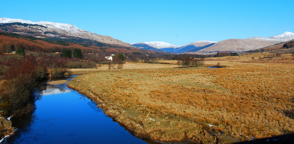
The line descends steeply as it clings to the hillside and crosses Manse Viaduct to reach the twin villages of Arrochar & Tarbet.
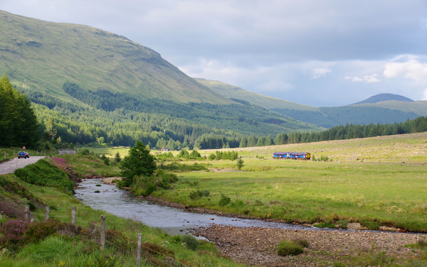
Between Garelochhead and Arrochar & Tarbet
Photo credit: “ScotEaster2013_23” by Richard Szwejkowski, CC BY-SA 2.0
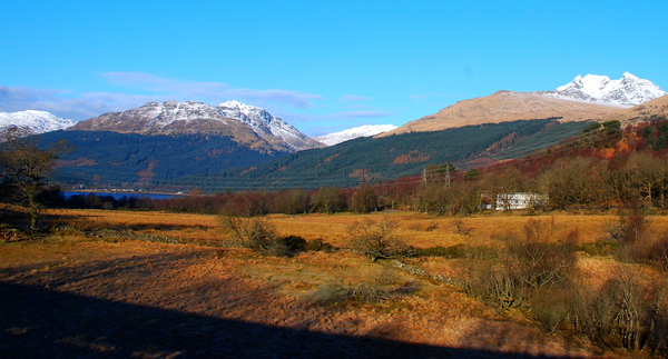
A few minutes beyond the station, the banks of Loch Lomond come into view. On the opposite shore, the dominant hill is Ben Lomond.
The most popular station for the Loch is at Balloch on a different line. However, people who prefer to get into some of the more remote parts of the Loch Lomond and the Trossachs National Park use these stations on the West Highland Line.
The train now passes through the Park, which became Scotland’s first national park in 2001. It sometimes surprises visitors to know that Scotland with its spectacular scenery has been so slow in creating parks.
The Loch itself has been popular with railway passengers for years having been heavily promoted by the London & North Eastern and British Railways in artist-commissioned paintings which perhaps depict the Loch as a model of perfection which it cannot quite live up to.
The train continues alongside the Loch until the station at Ardlui is reached. The train leaves the lochside behind as the line now heads cross country towards Crianlarich.
On the right Ben Glas mountain comes into view closely followed by the Falls of Falloch and then Ben Chabair (1523 feet). The railway closely follows the route of the West Highland Way walk and walkers can often be seen from the train. For those opting to walk to Fort William, good views and photography of the railway may be enjoyed.
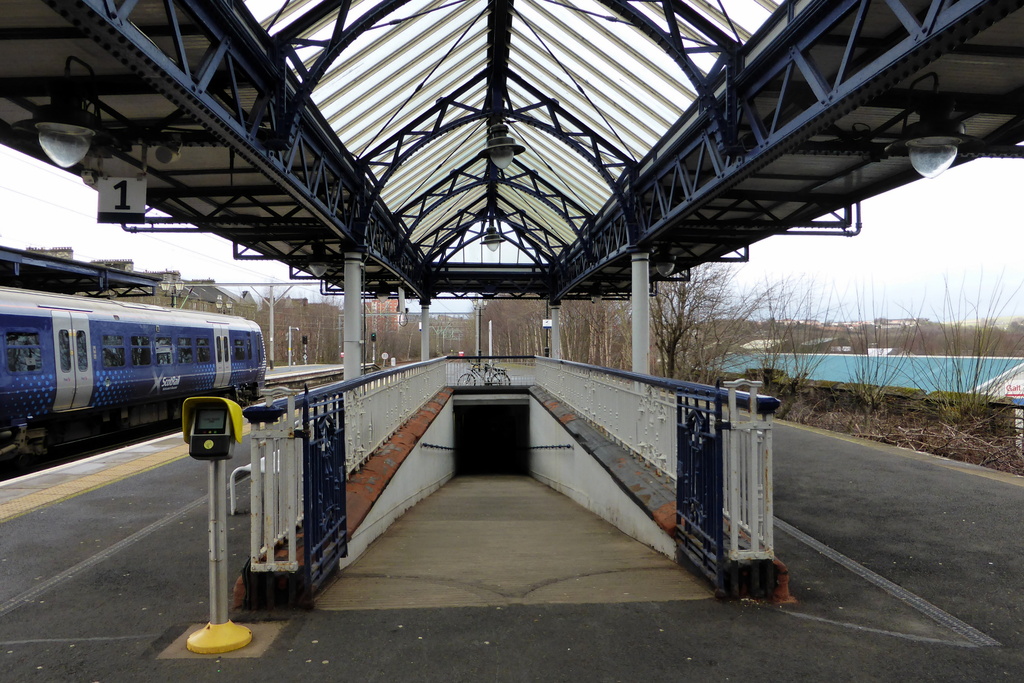
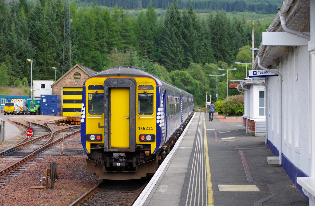
The train next stops at Crianlarich. This location has developed as a junction for the railway and a small settlement now exists.
Unfortunately the tearoom is permanently closed. The former stone engine shed still exists and is now used for track maintenance vehicles.
Prior to the closure of the line going east towards Stirling in 1965, this was where the West Highland Railway and Oban railway crossed (although there was a connection). When the line east was closed due to a rockslide, the Oban trains were rerouted by the West Highland line from Glasgow to Crianlarich.
Trains now divide here with one portion going to Oban and the other to Fort William. Make sure you are on the correct portion of the train for the destination you intend to reach.
Crianlarich Railway Station
Photo credit: “IMGP1637” by Matt Buck, CC BY-SA 2.0
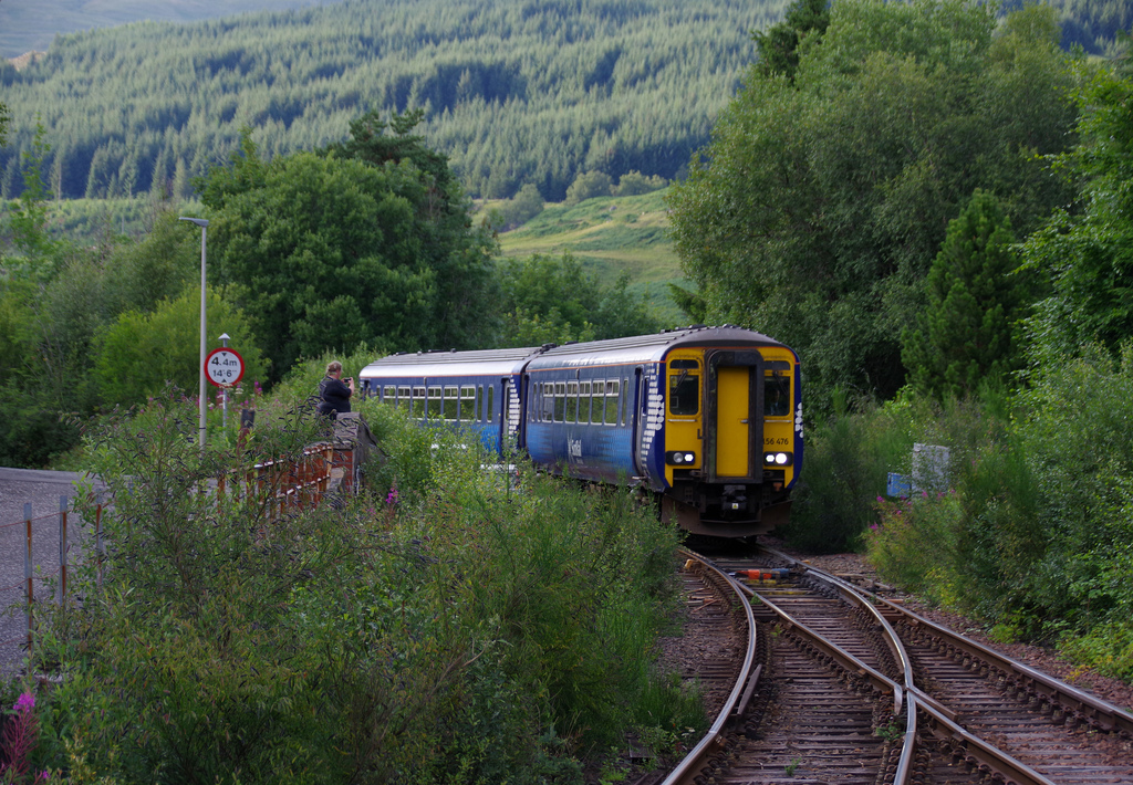
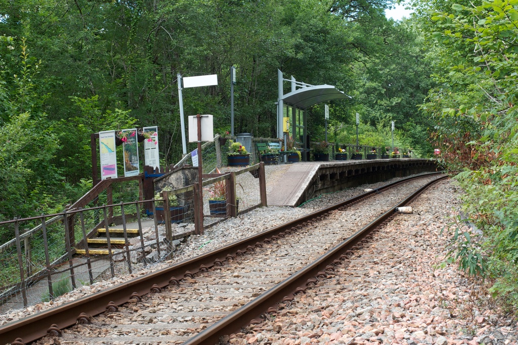
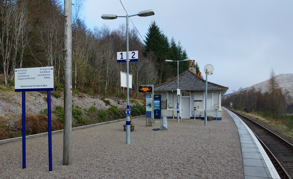
On departure from Crianlarich Station the first stop is at Tyndrum Lower Station. Not to be confused with the tiny village’s other station, Upper Tyndrum – which is on the Fort William section of this line!
The railways to Fort William and Oban travel together towards Tyndrum where they split and you may often see the other portion of the train across the river on the opposite line.
Oban to Glasgow service arrives at Crianlarich Station
Photo credit: “IMGP1647” by Matt Buck, CC BY-SA 2.0
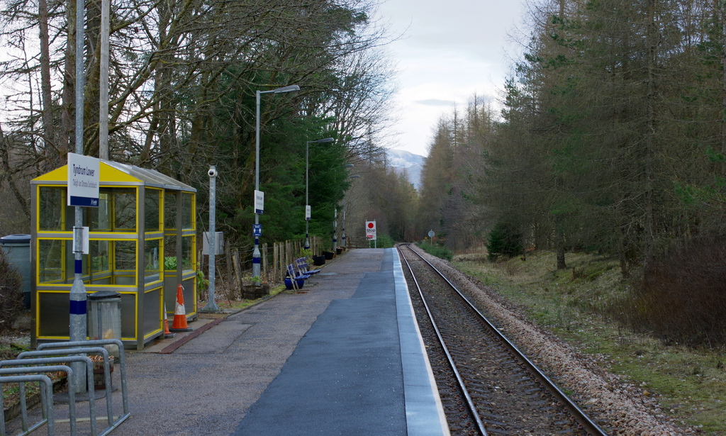
View south along the platform at Tyndrum Lower railway station
Photo credit: “IMGP8634” by Matt Buck, CC BY-SA 2.0
The train now makes its way west through Glen Lochy. The Glen is steep with hills on either side and is nicely wooded. Have your camera ready when passing Lochan ni Bi, just after Tyndrum.
There are many other scenic locations along this stretch of line as it follows the course of the River Lochy through the narrow valley.
The next stop is at Dalmally. The station has an attractive stone building, which has been converted into accommodation.
Train heads east through Glen Lochy towards Crianlarich
Photo credit: “IMGP8794” by Matt Buck, CC BY-SA 2.0
Dalmally station at night
Photo credit: “IMGP3332” by Matt Buck, CC BY-SA 2.0
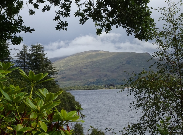
The railway suddenly emerges to cross the Orchy Viaduct and share the banks of Loch Awe. On the left look out for views of Kilchurn Castle.
This is one of the most famous views in Scotland and an ideal photo opportunity from the carriage window. The small halt at Loch Awe serves the village of the same name.
Framed Kilchurn Castle. From outside St Conan's Kirk, Loch Awe.
Photo credit: “Framed Kilchurn Castle” by Phil Gayton, CC BY 2.0
The train continues along the banks of Loch Awe to Falls of Cruachan. The tiny request stop station at Falls of Cruachan is open during the summer only as there is no station lighting.
The station opened as long ago as 1893 and is purely a tourist destination, there being no settlement here.
Falls of Cruachan Railway Halt
Photo credit: “Falls of Cruachan Railway Halt” by Tom Parnell, CC BY-SA 2.0
On departure from the station, enjoy the views of the River Awe as the train makes its way up the ravine.
Taynuilt lies near to the south shore of Loch Etive. The line now follows the scenic south shore of Loch Etive with views across the entire length of the Loch.
You pass the site of Ach-na-Cloich station which once served steamers on the Loch, although nothing now remains.
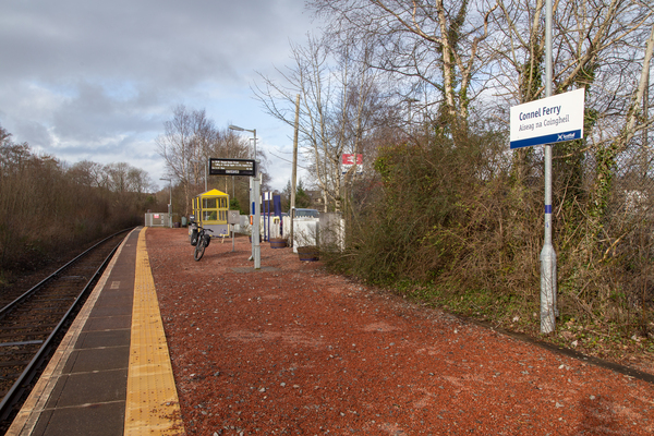
Connel Ferry is a small halt which serves this village. You can still see the bridge which once carried a branch line north to Ballachullish. Although the line closed, pedestrians may still use the bridge to reach North Connel village.
Connel Ferry Station
Photo credit: “Connel Ferry Station” by Tom Parnell, CC BY-SA 2.0
The line now heads down across Glencruitten Summit (301 feet) and then steeply down into Oban through rock cuttings which allow the line to descend so quickly into the seaside town.
Oban railway station is located at the harbour and right next to the Caledonian MacBrayne Ferry Terminal. Sadly the attractive original station with glazed platform canopies and clock tower was allowed to fall into disrepair and was demolished in the 1980s.
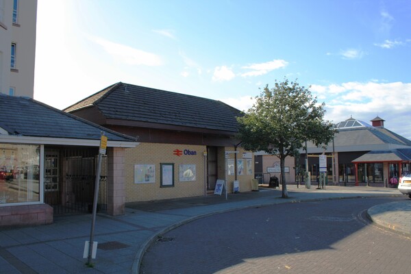
Oban Railway Station - this photo is one of ours!
Departing Crianlarich the train soon arrives at Upper Tyndrum Station. Not to be confused with the tiny village’s other station, Tyndrum Lower – which is on the Oban section of this line!
The railways to Fort William and Oban travel together towards Tyndrum where they split and you may often see the other portion of the train across the river on the opposite line.
Crossing the River Fillan as the train departs from Crianlarich
Photo credit: “ScotEaster2013_26” by Richard Szwejkowski, CC BY-SA 2.0
View south along the platforms at Upper Tyndrum railway station
Photo credit: “IMGP8597” by Matt Buck, CC BY-SA 2.0
The train departs and makes its way around the hill Ben Odhar before traversing a unique horseshoe curve, where the line will double back on itself. Have your camera ready for this particularly scenic section of the railway.
Bridge of Orchy is one of many points where the West Highland Way walk is crossed. On departure from Bridge of Orchy the line travels alongside Loch Tulla while the West Highland Way takes a route behind the Loch and through the hills.
Just after the Loch are the remains of Achallader Castle. This was a 16th century tower but only two walls now remain.
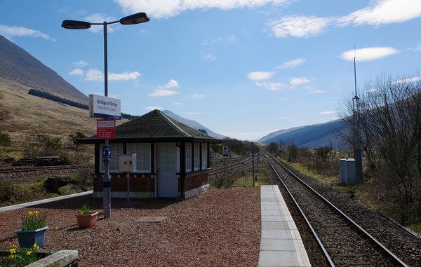
Bridge of Orchy railway station
Photo credit: “IMGP9912” by Matt Buck, CC BY-SA 2.0
The train now begins its crossing of Rannoch Moor. While diesel trains make light work of the route, this was a challenge to the crews of the steam powered trains which once made their way across this line (and still do on special occasions!).
The West Highland Way walking route skirts the edge of the moor, but the railway crosses through its heart. To achieve this feat of engineering the line was ‘floated’ across using tree roots, bushes and thousands of tonnes of earth.
The landscape is a treat for the visitor. Watch this expanse of peat bogs, lochans, streams and ancient forests slowly pass by.
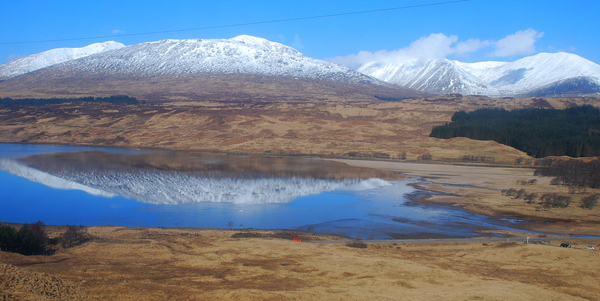
Loch Tulla
Photo credit: “ScotEaster2013_56” by Richard Szwejkowski, CC BY-SA 2.0
Rannoch Station is the stop for the moor. It is situated on the huge Rannoch plateau, 1000 feet above sea level and surrounded by hills.
When the route of the line was being surveyed the party conducting the evaluation decided to walk across the moor in winter. Being ill prepared and in the most remote part of the UK they almost perished having got into trouble.
When construction of the railway began, it was not the end of the challenges at this location. The moor not only swallowed materials but money and at one stage the whole scheme was in danger of financial collapse.
One of the Directors, Mr J Renton, stepped in with his own money and saved the project. Afterwards grateful navvies (the people who manually built the line) rolled a huge boulder onto the platform at Rannoch Station and carved an image of Renton in his honour. It is still there today for passengers to view.
Rannoch Station
Photo credit: “Rannoch Station, December 2023” by alljengi, CC BY-SA 2.0
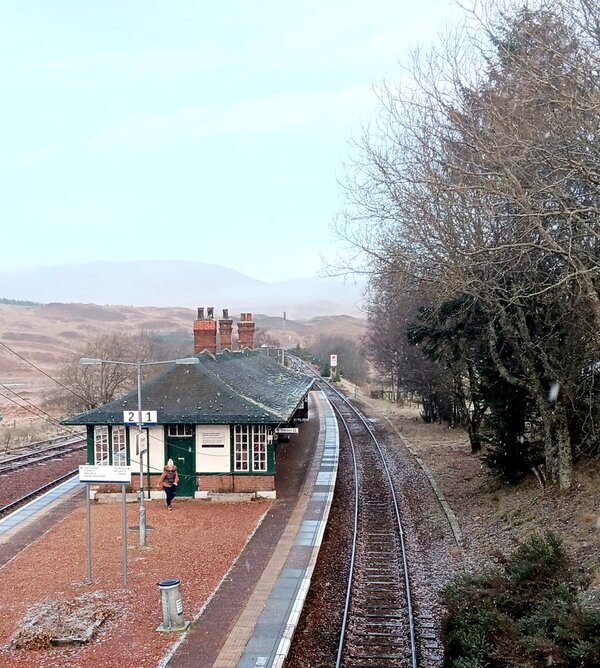
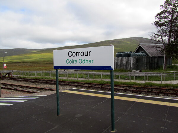
The line continues through the wetlands to Corrour Station. This is the highest point on the line, and the highest mainline station in the UK, being 1350 feet above sea level.
While the station has been here since the line opened for railway workers and the local estate, it did not officially open to the public until 1934. It was also used by navvies working on the Kinlochleven hydro electric dam some ten miles to the west.
Corrour Railway Station
Photo credit: “Corrour Railway Station” by David Jones, CC BY 2.0
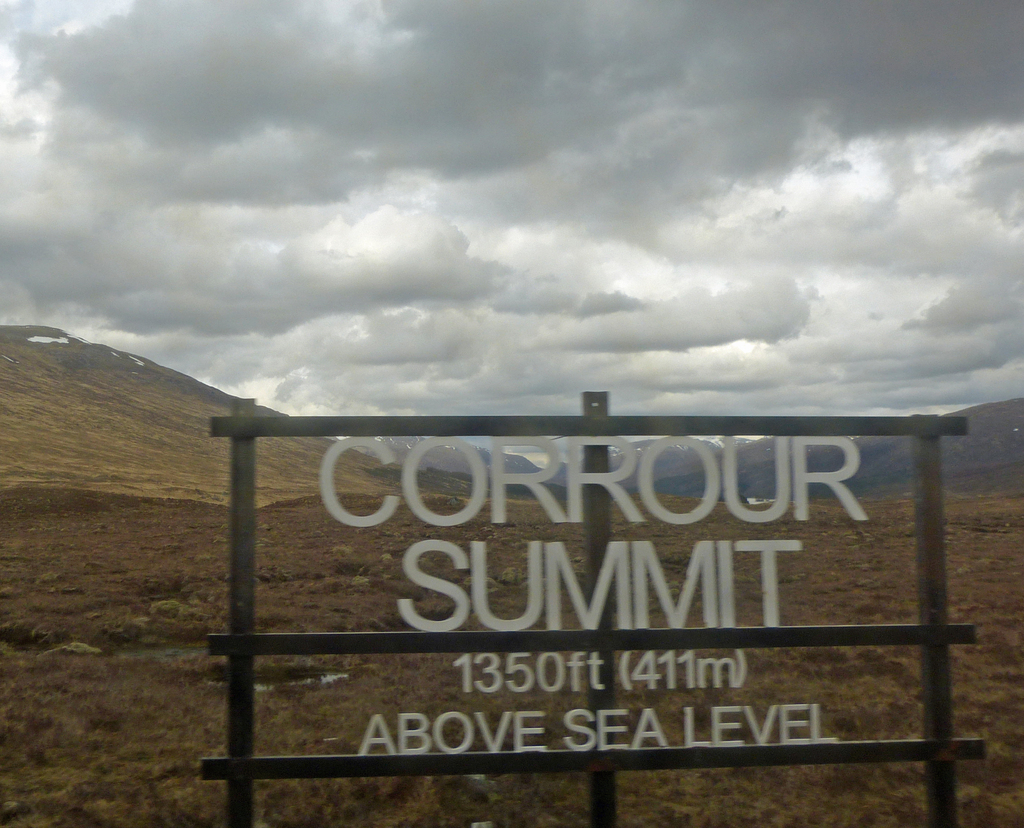
Corrour Summit sign
Photo credit: “Downhill All The Way” by Andrew, CC BY 2.0
The railway travels alongside Loch Treig before descending from the moor into the relatively fertile and contrasting Glen Spean. Tulloch is the first station in this area.
There was once a proposal to join the Highland Mainline to the west at Tulloch, providing a rail link from Inverness to Fort William. With the likely limited traffic levels this was never given serious consideration but it would have been a really useful transport link.
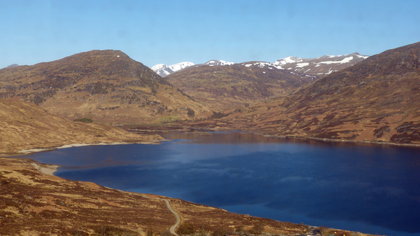
Loch Treig from the West Highland Line
Photo credit: “Loch Treig From The West Highland Line” by Andrew, CC BY 2.0
Tulloch Railway Station
Photo credit: “Tullloch Railway Station” by Andrew Bowden, CC BY-SA 2.0
The train now heads through the woods and valley to Roy Bridge Station. Just before Roy Bridge station look out for the waters of Monessie Gorge.
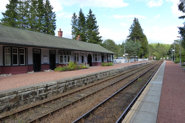
It is shortly followed by Spean Bridge. Just out of sight on the hill to the right is the monument to the commandos who trained here during the Second World War.
It is easy to see why such a location was chosen as the terrain can be harsh even in summer. If you decide to take a coach from Fort William or Spean Bridge to Fort Augustus or Inverness, you will pass right by the memorial. See our Guide to the coach journey between Inverness and Fort William.
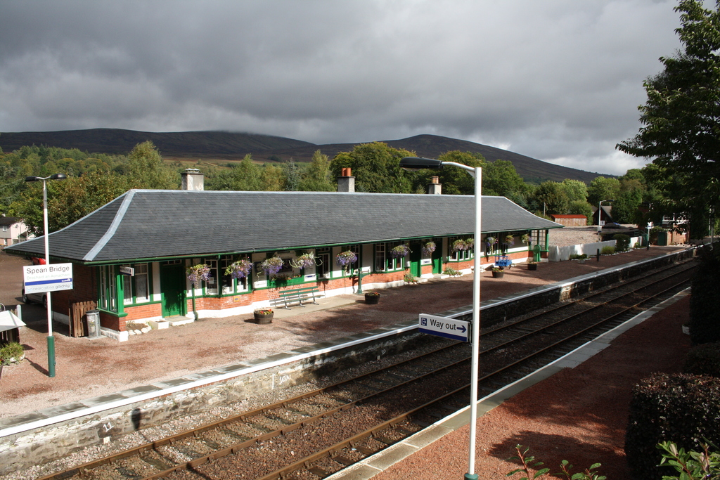
Spean Bridge Railway Station - this photo is ours!
The journey is now almost over as the train covers the last few miles into Fort William.
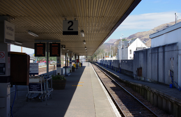
Looking along the platforms at Fort William railway station
Photo credit: “IMGP0315” by Matt Buck, CC BY-SA 2.0
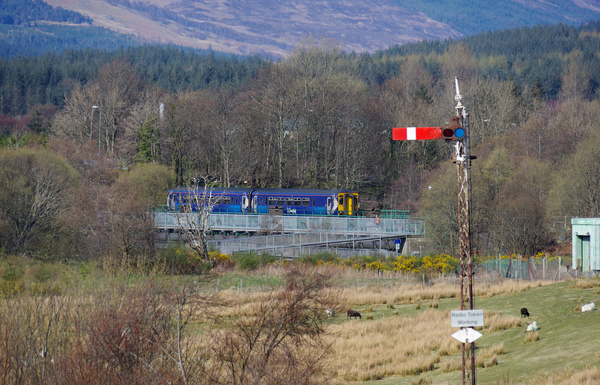
Upon leaving Fort William station the train passes Fort William signal box. The station area is still controlled by the traditional semaphore signalling system, although the rest of the entire West Highland route system has long since changed to a new radio signalling system.
This signal box was once named Mallaig Junction (to mark the start of the Mallaig extension) but was renamed to avoid confusion. The train passes the Fort William rail yards which during the summer are busy servicing the steam locomotives of the West Coast Railway Company.
Fort William to Mallaig service crossing the River Lochy
Photo credit: “IMGP0426” by Matt Buck, CC BY-SA 2.0
Banavie is the first stop on the extension as the train slows to cross the Caledonian Canal at its southernmost end. The canal was constructed by Thomas Telford.
It was designed to cross Scotland and avoid the long and hazardous shipping route around the north coast. Today it is popular for leisure sailing and for cycling and walking along its length.
On leaving Banavie, look out for the new signalling centre controlling the entire West Highland Lines. It is built in the style of a traditional signal box although it is actually packed with modern electronics.
The train winds back towards the sea which is now starting to form the sea loch of Loch Eil. At this point it is known as ‘the narrows’ and the name is appropriate with the hills of the opposite shore being very close at this point.
Corpach Station is next to the beautiful sea loch of Loch Eil which is on the left side of the train. There are also wonderful views back towards Fort William and Ben Nevis.
Loch Eil Outward Bound stop was constructed from old railway materials to serve the outdoor recreation centre located here. The train continues alongside Loch Eil for several miles on this particularly beautiful stretch of line.
Locheilside Station request stop serves this remote area before the train heads inland through the narrow pass which brings the line to Glenfinnan.
The line heads around a long and tight curve which takes it over the famous Glenfinnan Viaduct. For the best view be on the left of the train when going north and the right of the train when going south.
The railway was built by Sir William MacAlpine who was nicknamed ‘Concrete Bob’ for his innovative use of the material on the line. The viaduct at Glenfinnan is constructed entirely of concrete and rises to a height of 100 feet as it crosses the valley. This was the first concrete viaduct in Britain.
There are wonderful views down to Loch Shiel at this point. Beside the shore you will see the Glenfinnan Monument, constructed to mark the landing of Bonnie Prince Charlie and the spot he started his 1745 Jacobite uprising.
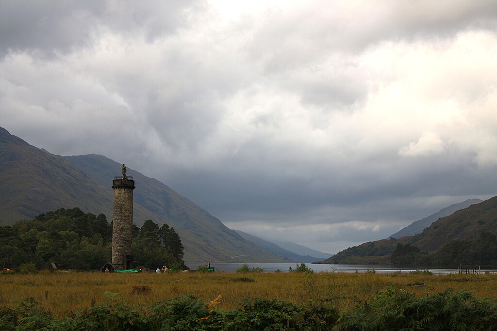
Glenfinnan Monument - this photo is ours!
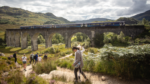
Scotrail train crossing Glenfinnan Viaduct
Photo credit: “scotrail” by london road, CC BY 2.0
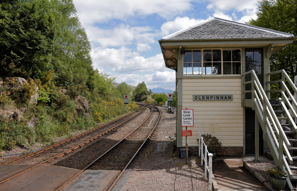
Glenfinnan Station Signal Box
Photo credit: “Glenfinnan Station 3 5 2019 1a” by Alex M Shepherd, Public Domain Dedication (CC0)
Between Glenfinnan and the next station at Lochailort, the train first makes its way between some of the highest mountains to surround any British train journey.
At between 500 and 790 metres the hills tower above the train on either side and with their steep sides seem to come right up to the carriage windows. They get only slightly less dramatic and tall as the train clings to the hillside to negotiate the edges of Loch Eilt.
Unsurprisingly the location, along with much of the West Highland Line, is a favourite with railway photographers. Another narrow pass is negotiated in the foot of Creag Bhàn Mountain (510 metres) on the right of the train.
A request stop is made at Lochailort Station. Another hotspot for railway photography with the nearby Lochailort Viaduct and surrounding hills, this is also a popular location with walkers.
While less visible, the train traveller will encounter seven tunnels in the few miles surrounding this station. Look out on departure for amazing views on the left down Loch Ailort.
Also at this point look out for the small white church of ‘Our Lady of the Braes’. Although there has not been a service here since 1964, it has been made famous by photographers of the West Highland Railway.
The train crosses the small peninsula before heading through a series of tunnels and alongside the incredibly rocky and rugged coastline which is crossed on Loch nan Uamh Viaduct. Although less famous than Glenfinnan Viaduct it is arguably the more scenic with its coastal setting.
The small request stop at Beasdale was once a private station for Arisaig House. It is passed just before another viaduct at Borrodale before Arisaig is reached.
The pleasant station at Arisaig has been unstaffed for many years, although it still provides a vital transport link to this remote community.
After departure from the station look over Loch Nan Ceall for views of the islands of Rum and Eigg with its distinctive flat top. The view of the islands is short before the line heads inland and north for the final stretch before Mallaig.
At the small station of Morar look to the right to see Loch Morar. This is Scotland’s deepest Loch while it also has Scotland’s shortest river running out and into the sea on the opposite side of Morar. The white sands of the beach were made famous by the 1983 film, ‘Local Hero’.
The train heads through a few hills before returning to the sea for the short section into Mallaig station. This is a simple two platform station with an attractive stone built station building.
Mallaig Railway Station - this photo is ours!
Page last updated 20 February 2026